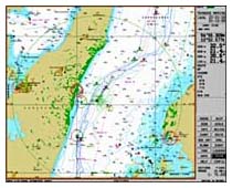
The electronic-cartographic information system Navi-Sailor Office is designed to monitor the actions of navigators on the part of employees of the security services of shipping companies. The system has all the basic functions of ECDIS, except for the ability to connect external sensors. Using the “Navi-Sailor Office”, the shipowner has a unique opportunity to collect and play tracks of his ships in the office.
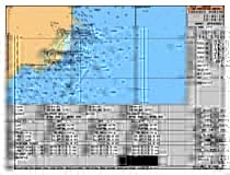
 All the navigation parameters are included in the recorded information, and in the case of using a radar integrator as part of the ship’s EX, information about all the targets. Moreover, information about the goals is recorded regardless of the actions of the operator. The radar integrator is designed to process an echo signal from a radar or ARPA and is designed in such a way that all targets on a given range scale in an amount of up to 500 pieces are processed, tracked and written to disk regardless of operator actions automatically. Recording can take several years. Within a month, you can record the entire raw radar image of each revolution of the antenna with the ability to play any section. The vectors of targets followed are shown to the operator only at his command. Recording a raw radar image is almost impossible to fake and it can be good evidence in the event of a trial, and the shipowner has the right to decide whether it is beneficial for him to present it, since such a recording is not mandatory.
Such unique capabilities allow you to use track recordings for post-trip analysis on the shore, analysis of the most difficult moments, for training, emergency prevention, dangerous maneuvers, too large deviations from the laid route and unjustified stops and delays.
Using the Navi-Sailor Office EX for planning and calculating the route of the vessels of the company, employees of the Maritime Safety Service can recommend the route that is optimal from a navigational and economic point of view to all ship captains, which is especially important in linear navigation. Such recommendations can bring real economic benefits to the shipowner.
Specification:
Basic functions of Navi-Office software:
- Route planning and work with the route
- Ship log and data archiving
- Printing a ship’s logbook, route, screen copies
- Work with an electronic card
- Signaling
- Hint Function
- Search and rescue operations
- Information on currents, winds, waves, ports, tides
- Working with user-created cards
- Work with cards of various formats
- Customizable screen resolution (1280×1024)
- Playback Mode (Black Box)
Options for the “Navi-Sailor Office” software:
- Radar integrator
- Transte production Navtex receiver with software
- Software Option “Trial Manoeuvering”
- Display of Official S-57.3 format cards (IHO-52)
- Weather module “Weather Wizard”