Nautical charts, charts, hydrometeorological manuals and other navigation guides can only ensure the navigational safety of navigation if they are constantly maintained at the level of modernity through their proofreading.
Therefore, timely identification and receipt of all significant changes in the terrain that have occurred since the publication of the manuals is very important in improving the quality of the latter.
In this case, the captains and navigators of ships can be of great help by collecting the necessary information during the voyage.
To provide boatmasters with methodological assistance in collecting proofreading materials, special instructions were issued in 1959 for navigators of ships and vessels, which set out both the methodology for performing these works, and the procedure for their registration and submission to the Hydrographic Service.
However, this is far from enough. An improvement in the quality of navigation aids can be achieved if a wide range of boatmasters are involved.
What is required of each of them when collecting materials for proofreading?
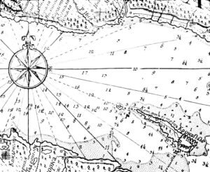
First of all, it is necessary to note the detected inconsistencies of maps and other guides for navigation with the terrain, to supplement the manuals with information that may be useful for navigators visiting this area for the first time, to conduct a passing measurement in areas with sparse soundings, “white spots” on maps, to compare the identity of the image of the area on the radar indicators with the corresponding contours of marine navigation maps and to assess their convergence, to photograph and sketch navigational landmarks and coastal views for placing them in loci.
If cans and other navigational obstacles that pose a danger to navigation are found that are not shown on the maps, it is necessary to determine their location more precisely and immediately inform the Hydrographic Service by radio or telegraph.
It should be emphasized that all information provided for the proofreading of maps and navigation manuals must be reliable and, if in doubt, clarified and verified on the spot. Otherwise, the use of proofreading materials will not lead to an improvement in the quality of navigation aids, but, on the contrary, to clogging them with unreliable data. Therefore, if it is not possible to verify the data obtained due to the conditions of navigation or the nature of the discrepancies, all doubts about the reliability of the information should be specified in detail in the submitted materials.
All observed discrepancies between the maps and the terrain are marked on the map and entered in the notebook of notes on proofreading. Coastal objects visible from ships should be determined with control, i.e. by at least three lines of position and by the most accurate navigation methods – by two angles, three directions, etc. Moreover, all data for determining the location of the ship and the object must be recorded in a notebook of notes on proofreading.
When making a passing sound, it is necessary to pay special attention to the careful determination of the ship’s position according to the most reliable and well-recognized navigational landmarks, with the expectation of having a definition every 5-10 cm on the map scale. When measuring in the open sea, the definitions are made by astronomical and radio navigation observations.
The laying of the sound tacks between the observatories is carried out by counting, in which the influence of compass corrections, lag, as well as current and drift should be carefully taken into account.
The depth during the measurement is measured continuously. In the open sea at great depths, measurements should be made at regular intervals with the expectation of having the measured depths at 1-2 cm on the map scale. The results of the passing sound must be entered in the specially developed and published Hydrographic Service forms of passing sound so that when they are filled in, it is possible to completely restore the laying of the ship’s path and put the measured depths on the map.
When proofreading a lot, all necessary corrections and additions to the text of the lot are recorded in a notebook of notes on proofreading, similar to the text of the proofreading of the lot in Notices to navigators.
When navigating with the use of radar, the information describing the reflecting properties of the coast, the quality of its image on the radar screen and the degree of compliance of the latter with the map are clarified and supplemented.
When using the manuals “Lights and signs” and “Radio-technical means of navigation equipment”, the discrepancy between the location, type (design), color and nature of the lights of coastal and floating fences, as well as the discrepancy between the operation of radio-technical means of the data specified in the manuals, is noted.
In order to supplement the navigation guides with illustrations of coastal views and conspicuous points, it is necessary to photograph them or make sketches that ensure full identification of landmarks, but if possible from places close to the usual routes of ship traffic.
From hydrometeorological manuals, current atlases, ice sheets, and current tables are subject to verification in ship conditions.
All collected materials on the proofreading of navigation manuals should be sent to the Hydrographic Service.
Entries in the notebook of notes on proofreading and other materials should be made carefully and clearly, since carelessness in the design of materials can lead to difficulties and even errors in the proofreading of navigation aids.
We have here briefly outlined mainly the complex of works and the amount of information that is of interest for the proofreading of nautical charts and manuals for navigation. Given the number of sailing vessels and the variety of their routes, there is every opportunity to obtain very valuable and important material that can be of great use in maintaining navigation manuals at the level of modernity.
Original:Сбор сведений для корректуры морских пособий (seaman-sea.ru)